Have you ever wondered what weather software the experts use to make accurate forecasts? Well, in this article, we will take a glimpse into the world of meteorology and explore the innovative tools that meteorologists rely on to predict the ever-changing weather conditions. From sophisticated computer models to advanced satellite imagery, we will uncover the secrets behind the software that helps meteorologists decipher the atmospheric puzzle. So, get ready to embark on a fascinating journey into the fascinating world of weather forecasting!
This image is property of www.presentationpoint.com.
Review contents
1. Radar Software
Radar software plays a crucial role in meteorology, allowing meteorologists to track and analyze the movement of rain, snow, and severe weather events. There are several popular radar software options available, each with its own unique features and capabilities.
1.1 WSI Max
WSI Max is a widely used radar software that provides meteorologists with real-time access to high-resolution radar data and advanced storm tracking capabilities. With its user-friendly interface, meteorologists can easily analyze precipitation patterns, track severe weather systems, and issue accurate forecasts. WSI Max also offers customizable overlays, such as storm reports and lightning strike data, to enhance the analysis and forecasting process. Additionally, it provides access to a comprehensive suite of weather models, allowing meteorologists to integrate numerical weather prediction data into their analysis.
1.2 GRLevelX
GRLevelX is a powerful radar software known for its advanced display options and customizable features. It offers a wide range of radar products, including reflectivity, velocity, and correlation coefficient, allowing meteorologists to assess storm structure and identify potential threats. GRLevelX also provides access to real-time lightning data and storm reports, which can be overlaid on the radar display for enhanced situational awareness. With its comprehensive set of features and intuitive interface, GRLevelX is a popular choice among meteorologists for storm tracking and analysis.
1.3 Gibson Ridge Software
Gibson Ridge Software offers a variety of radar software options designed for meteorological analysis. Their software products, such as GR2Analyst and GRLevel3, provide meteorologists with high-quality radar data and advanced visualization capabilities. These software packages allow users to view different radar products simultaneously, analyze storm attributes, and track severe weather systems. Gibson Ridge Software also offers customizable display options, including the ability to overlay storm reports, lightning data, and other relevant information. With its robust features and user-friendly interface, Gibson Ridge Software is widely used by meteorologists for radar analysis and forecasting.
2. Satellite Imagery Software
Satellite imagery software is essential for meteorologists to monitor weather systems, track cloud formations, and analyze atmospheric conditions. These software tools provide access to real-time satellite imagery, allowing meteorologists to observe weather patterns and make more accurate forecasts.
2.1 CIRA SLIDER
CIRA SLIDER is a satellite imagery software developed by the Cooperative Institute for Research in the Atmosphere (CIRA). It offers meteorologists access to a wide range of satellite imagery, including visible, infrared, water vapor, and other specialized products. CIRA SLIDER allows meteorologists to view satellite imagery at different wavelengths and enhance the visualization of various atmospheric features. The software also provides tools for animating satellite loops, overlaying other weather data, and generating customized imagery products. With its comprehensive satellite imagery capabilities, CIRA SLIDER is a valuable tool for meteorologists in weather analysis and forecasting.
2.2 McIDAS
McIDAS (Man computer Interactive Data Access System) is a popular satellite imagery software widely used in the meteorological community. It provides meteorologists with access to real-time and archived satellite data from various satellite sensors. McIDAS offers a wide range of image enhancement and manipulation tools, allowing users to analyze satellite imagery in detail. The software also provides features for animating satellite loops, overlaying other weather data, and creating customized visualizations. With its extensive capabilities and user-friendly interface, McIDAS is a valuable tool for meteorologists in satellite data analysis and interpretation.
2.3 GOES-R Satellite Viewer
The GOES-R Satellite Viewer is a software tool specifically designed for viewing and analyzing satellite imagery from the GOES (Geostationary Operational Environmental Satellite) series. It provides meteorologists with access to high-resolution satellite imagery, allowing them to monitor weather systems and track the development of severe storms. The GOES-R Satellite Viewer offers various image enhancement and manipulation options, including the ability to animate satellite loops and overlay weather-related data. With its specialized focus on GOES satellite imagery, the GOES-R Satellite Viewer is an invaluable tool for meteorologists working with this particular satellite system.
3. Numerical Weather Prediction Models
Numerical weather prediction (NWP) models are essential tools for meteorologists in forecasting weather conditions and understanding atmospheric processes. These models simulate the behavior of the atmosphere based on mathematical equations, meteorological observations, and other relevant data.
3.1 GFS
The Global Forecast System (GFS) is one of the most widely used NWP models globally. Developed by the National Centers for Environmental Prediction (NCEP), the GFS model provides meteorologists with forecasts for temperature, precipitation, wind, and other atmospheric variables for global and regional scales. The model uses a grid system to divide the atmosphere into smaller grid points, allowing for more detailed predictions. Meteorologists rely on the GFS model to analyze large-scale weather patterns, identify potential storm systems, and make short and medium-range forecasts.
3.2 ECMWF
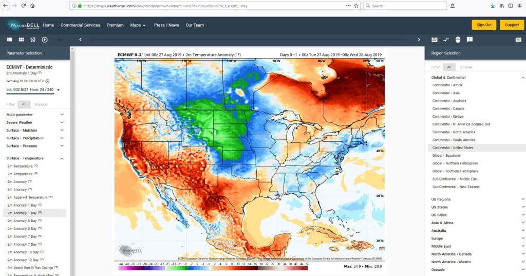
The European Centre for Medium-Range Weather Forecasts (ECMWF) operates one of the most advanced NWP models in the world. The ECMWF model, also known as the Integrated Forecasting System (IFS), provides meteorologists with high-resolution forecasts for a wide range of atmospheric variables. It uses advanced data assimilation techniques and numerical algorithms to simulate the behavior of the atmosphere. The ECMWF model is renowned for its accuracy and reliability, making it a preferred choice for meteorologists in operational forecasting and research.
3.3 NAM
The North American Mesoscale (NAM) model is a regional NWP model developed by the National Weather Service (NWS) in the United States. It focuses on providing detailed forecasts for smaller geographical areas, such as individual states or regions. The NAM model uses a high-resolution grid system to capture small-scale weather features, including convective storms and localized precipitation patterns. Meteorologists rely on the NAM model for short-term forecasts, particularly in areas prone to severe weather events. The NAM model provides valuable insights into the evolution and behavior of mesoscale weather systems.
4. Climate Analysis and Monitoring Tools
Climate analysis and monitoring tools are essential for meteorologists in studying long-term weather patterns, understanding climate change, and assessing historical climate data. These tools allow meteorologists to analyze and visualize climate data, build statistical models, and perform in-depth climate studies.
4.1 Climate data analysis tools
Climate data analysis tools, such as Climate Data Operators (CDO) and Climate Analysis Indicators Tool (CAIT), provide meteorologists with the ability to process and analyze large volumes of climate data. These tools offer a wide range of statistical and computational functions, allowing users to calculate climate indices, extract specific variables, and perform trend analysis. Climate data analysis tools are essential for meteorologists in identifying climate trends, detecting anomalies, and investigating climate variability.
4.2 Climate modeling tools
Climate modeling tools, such as the Community Earth System Model (CESM) and the Max Planck Institute Earth System Model (MPI-ESM), are used by meteorologists to simulate and predict future climate conditions. These tools incorporate various components of the Earth system, including the atmosphere, oceans, land surface, and biological processes. Climate modeling tools allow meteorologists to investigate the potential impacts of greenhouse gas emissions, land-use changes, and other factors on future climate scenarios. They are vital in understanding the complex interactions within the Earth’s climate system and projecting future climate conditions.
4.3 Climate data visualization tools
Climate data visualization tools, such as Climate Explorer and Panoply, provide meteorologists with the ability to visualize and present climate data in a meaningful way. These tools offer a range of graphical options, including maps, graphs, and animations, allowing users to effectively communicate climate information. Climate data visualization tools are essential for meteorologists in conveying complex climate data to policymakers, stakeholders, and the general public. They play a crucial role in raising awareness about climate change and facilitating informed decision-making.
This image is property of www.newscaststudio.com.
5. Weather Data Acquisition and Analysis Tools
Weather data acquisition and analysis tools are essential for meteorologists in collecting, processing, and analyzing weather observations. These tools enable meteorologists to obtain real-time weather data from various sources, such as weather stations, weather balloons, and weather buoys.
5.1 Weather stations
Weather stations are equipped with sensors that measure atmospheric variables, such as temperature, humidity, wind speed, and precipitation. These stations are strategically located to provide representative measurements of weather conditions in specific areas. Meteorologists rely on weather stations to gather real-time weather data and monitor local weather patterns. The data collected from weather stations is essential for forecasting, climate monitoring, and weather research.
5.2 Weather balloons and radiosondes
Weather balloons, equipped with radiosondes, are launched into the atmosphere to collect vertical profiles of temperature, humidity, pressure, and wind. Radiosondes transmit the collected data back to weather stations, allowing meteorologists to analyze the state of the atmosphere at different altitudes. Weather balloons provide crucial information about atmospheric stability, moisture content, and upper air patterns. Meteorologists use this data to improve weather forecasts, identify the potential for severe weather, and validate numerical weather prediction models.
5.3 Weather Buoy Observations
Weather buoys are deployed in oceans, lakes, and coastal areas to collect real-time weather and oceanographic data. These buoys are equipped with various sensors to measure parameters such as wave height, sea surface temperature, wind speed, and atmospheric pressure. Meteorologists rely on weather buoy observations to monitor marine weather conditions, track tropical storms, and assess the impact of weather on coastal regions. Weather buoy data is especially valuable in maritime forecasting, offshore operations, and climate studies.
6. Lightning Detection Software
Lightning detection software allows meteorologists to monitor and analyze lightning activity in real-time. This software provides valuable information about the location, intensity, and frequency of lightning strikes, helping meteorologists track severe weather systems and assess the potential for lightning-related hazards.
6.1 Vaisala Thunderstorm Manager
The Vaisala Thunderstorm Manager is a lightning detection software widely used by meteorologists for monitoring and analyzing lightning activity. It provides real-time lightning data, including the number of strikes, type of strikes (cloud-to-ground or intra-cloud), and the evolution of lightning clusters. The software offers advanced mapping and visualization features, allowing meteorologists to track the movement and intensity of thunderstorms. The Vaisala Thunderstorm Manager enables meteorologists to issue timely warnings for severe weather conditions, such as heavy rainfall, strong winds, and the potential for lightning-related injuries.
6.2 Earth Networks Total Lightning Network
The Earth Networks Total Lightning Network is a comprehensive lightning detection system that provides meteorologists with real-time lightning data from both cloud-to-ground and in-cloud lightning strikes. The network covers a global scale and offers high-quality lightning data for accurate analysis and forecasting. Meteorologists can use the Earth Networks Total Lightning Network to identify and track severe thunderstorms, assess the risk of cloud-to-ground lightning, and issue timely warnings to the public. The lightning data provided by this network is crucial for enhancing weather safety and mitigating the risks associated with lightning hazards.
6.3 WeatherBug Lightning & Severe Weather
WeatherBug Lightning & Severe Weather is a lightning detection software that provides meteorologists with real-time lightning data, storm intensity, and location information. The software offers customizable features, such as lightning density maps and lightning strike alerts, enabling meteorologists to monitor lightning activity with ease. WeatherBug Lightning & Severe Weather also provides historical lightning data, allowing meteorologists to analyze long-term lightning trends and patterns. This software helps meteorologists in assessing the severity of thunderstorms, identifying potential hazards, and issuing timely warnings to protect public safety.
This image is property of www.presentationpoint.com.
7. Forecasting and Warning Systems
Forecasting and warning systems are essential for meteorologists to provide accurate and timely weather information to the public and emergency management agencies. These systems integrate data from various sources, such as radar, satellite imagery, weather models, and observations, to produce reliable forecasts and warnings.
7.1 National Oceanic and Atmospheric Administration (NOAA) systems
The National Oceanic and Atmospheric Administration (NOAA) operates a range of forecasting and warning systems, including the National Weather Service’s (NWS) Integrated Dissemination Program (IDP) and the Public Alerting and Warning System (PAWS). These systems gather data from multiple sources and deliver weather forecasts, advisories, and warnings to the public through various communication channels, including radio, television, and online platforms. The NOAA systems play a crucial role in informing the public about severe weather events and helping them take appropriate actions to protect life and property.
7.2 Weather Decision Technologies
Weather Decision Technologies (WDT) develops forecasting and warning systems that incorporate advanced weather data analysis and visualization tools. Their systems provide meteorologists with real-time access to high-quality weather data, including radar, satellite imagery, and numerical weather prediction models. WDT forecasting and warning systems offer customizable alerting capabilities, allowing meteorologists to issue warnings for severe weather, such as tornadoes, hurricanes, and flash floods, to specific areas or user-defined regions. The WDT systems enable meteorologists to deliver accurate and targeted weather information, improving public safety and reducing the impact of weather-related hazards.
7.3 The Weather Company
The Weather Company, an IBM business, operates a comprehensive forecasting and warning system that combines meteorological expertise with advanced technology. The Weather Company’s forecasting and warning systems utilize a wide range of data sources, including radar, satellite imagery, weather models, and observations, to generate accurate and timely weather forecasts and warnings. Their systems deliver weather information through various platforms, including mobile applications, websites, and television broadcasts. The Weather Company’s forecasting and warning systems are widely used by meteorologists and media organizations to enhance weather communication and keep the public informed about impending severe weather events.
8. Climate Modeling Software
Climate modeling software is crucial for meteorologists and climate scientists in simulating and projecting future climate conditions. These software tools integrate various components of the Earth’s climate system, allowing users to explore the impacts of climate change, assess potential mitigation strategies, and study long-term climate trends.
8.1 WRF (Weather Research and Forecasting Model)
The Weather Research and Forecasting (WRF) model is a widely used, community-based climate modeling software. It is designed to simulate atmospheric processes across different spatial and temporal scales, making it suitable for regional and local climate studies. The WRF model provides meteorologists and climate scientists with the ability to investigate weather patterns, analyze climate variability, and project future climate scenarios. It offers a range of options for different scientific applications, including weather forecasting, air quality modeling, and atmospheric research.
8.2 CCSM (Community Climate System Model)
The Community Climate System Model (CCSM) is a state-of-the-art climate modeling software developed by the National Center for Atmospheric Research (NCAR). The CCSM integrates various components of the Earth’s climate system, including the atmosphere, oceans, land surface, and sea ice. The model allows scientists to simulate and project future climate conditions, assess the impacts of greenhouse gas emissions, and study the Earth’s climate history. The CCSM is widely used in climate research, providing valuable insights into climate change phenomena and informing policy decisions.
8.3 GISS ModelE
The GISS ModelE is a climate modeling software developed by the NASA Goddard Institute for Space Studies (GISS). It is designed to simulate complex interactions within the Earth’s climate system, including atmospheric dynamics, ocean circulation, ice dynamics, and biogeochemical cycles. The GISS ModelE enables meteorologists and climate scientists to investigate a wide range of climate-related phenomena, such as El Niño events, polar amplification, and carbon cycle feedbacks. The model provides valuable insights into climate processes, helping scientists better understand the Earth’s climate system and predict future climate changes.
This image is property of wildcardweather.files.wordpress.com.
9. Visualization and Presentation Tools
Visualization and presentation tools are essential for meteorologists to communicate weather and climate information effectively. These tools enable meteorologists to create compelling visualizations, interactive maps, and informative presentations to convey complex weather and climate data to a wide audience.
9.1 ArcGIS
ArcGIS is a powerful geographic information system (GIS) software that provides meteorologists with a range of tools for geospatial analysis and visualization. With ArcGIS, meteorologists can create interactive maps, overlay weather data with geographic features, and perform spatial analysis to identify weather patterns and trends. The software also offers options for data integration, allowing meteorologists to combine weather data from various sources and create comprehensive visualizations. ArcGIS is widely used by meteorologists for weather and climate research, decision-making, and public outreach.
9.2 Google Earth
Google Earth is a popular web-based application that allows meteorologists to explore the Earth through satellite imagery and aerial photography. Meteorologists can use Google Earth to visualize weather patterns, track storm systems, and overlay weather data on the 3D globe. The software offers a user-friendly interface and various tools for navigation and exploration, making it easy for meteorologists to discover and analyze weather and climate features. Google Earth is widely accessible and provides a valuable platform for meteorologists to share their findings with the public.
9.3 Weather Decision Support Systems (WDSS)
Weather Decision Support Systems (WDSS) are software tools designed to assist meteorologists in analyzing and visualizing weather and climate data for operational decision-making. These systems offer a range of features, including real-time data integration, radar display options, and severe weather alerting capabilities. WDSS provide meteorologists with the ability to analyze complex weather phenomena, such as tornadoes and severe thunderstorms, and generate actionable information for emergency managers and the public. WDSS are widely used in operational meteorology and play a critical role in providing timely and accurate weather information during hazardous weather events.
10. Communication and Collaboration Tools
Communication and collaboration tools are essential for meteorologists to interact with colleagues, share information, and coordinate efforts. These tools facilitate seamless communication, allowing meteorologists to exchange ideas, collaborate on research projects, and enhance operational efficiency.
10.1 Slack
Slack is a popular communication platform widely used by meteorologists for team collaboration and information sharing. The platform offers chat channels, private messages, and file sharing capabilities, enabling meteorologists to communicate effectively within their teams. Slack allows meteorologists to create dedicated channels for specific projects or topics, facilitating focused discussions and knowledge sharing. The platform also integrates with various other software tools, such as weather data analysis software and forecasting models, providing seamless workflow integration.
10.2 Microsoft Teams
Microsoft Teams is another widely used communication and collaboration platform that provides meteorologists with a comprehensive set of tools for teamwork and information sharing. Teams offers chat functionality, video conferencing, and document collaboration features, enabling meteorologists to communicate and collaborate in real-time. Meteorologists can create dedicated teams for specific projects, departments, or research groups, fostering effective communication and coordination. Microsoft Teams also integrates with other Microsoft productivity tools, facilitating seamless workflow management and enhancing productivity.
10.3 Zoom
Zoom is a popular video conferencing platform that provides meteorologists with the ability to host virtual meetings, webinars, and presentations. The platform offers high-quality video and audio capabilities, allowing meteorologists to engage in real-time discussions and presentations with colleagues, stakeholders, and the public. Zoom provides features for screen sharing, remote collaboration, and virtual breakout rooms, enabling meteorologists to conduct interactive meetings and collaborate effectively. The platform is widely accessible and user-friendly, making it a valuable tool for meteorologists in remote collaboration and communication.
This image is property of x-default-stgec.uplynk.com.


