It allows meteorologists to detect precipitation and forecast the weather. Like satellite imagery of clouds, radar helps meteorologists better understand the temperature around them, resulting in more accurate forecasts.
The use of radar in weather was discovered by accident. When radar operators began using radar to detect enemy ships and planes during World War II, they found that precipitation also caused false echoes.
Following WWII, military radars were repurposed for meteorological purposes, and upgrades enhanced their precipitation detection capabilities.
The weather radar imagery you see today in your weather radar app differs significantly from the imagery you saw in those early 1950s radars, but the basic principles remain the same.
The workings of modern weather radar
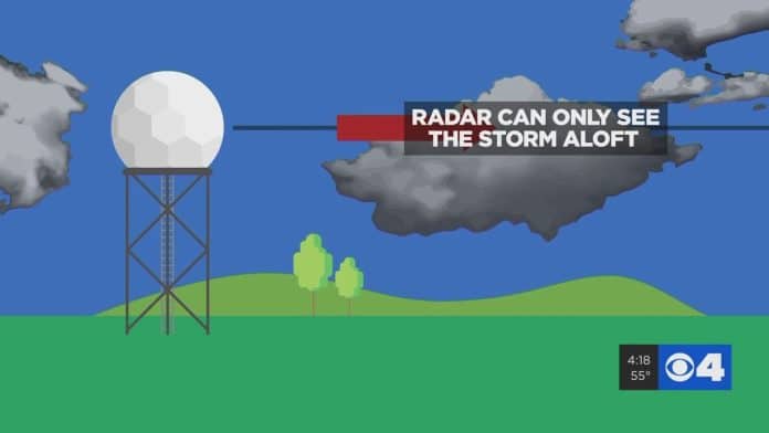
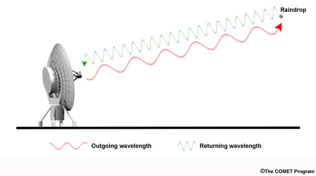
Radars work in the same way, regardless of their technology. An antenna emits a beam of radio waves outward.
If objects are in the air, such as rain, sleet, or snow, the radio waves bounce off those objects and scatter. Radars receive some scattered radio waves back, with larger objects recapturing more.
On television, the web, and your radar app, differences in reflectivity are plotted on a map to provide a view of precipitation within the radar’s range.
Doppler Radar: How Does It Work?
It works a little bit differently from older radars. Instead of merely measuring the reflectivity of precipitation, Doppler radar also detects its shape, position, and form.
By measuring this, a Doppler radar can also measure the velocity of rainfall moving toward or away from the radar.
In the past, meteorologists had to look for visual cues, known as hook echoes, to find tornadoes within storms.
Since not all tornadoes produce hook echoes, many were missed. In this way, Doppler radars can detect tornadoes exceptionally well.
Radar Doppler
A Doppler radar emits radio wave pulses and listens for returned signals. (Image Credit: NOAA)
The “Doppler shift” occurs daily when you sit at a light and wait for an emergency vehicle to pass or at a railroad crossing waiting for a train to blow its whistle.
You’ll notice that the pitch sound rises as it approaches, stays steady in front of you, and decreases in pitch as it moves away.
Those shifts are what a doppler radar detects, and that’s what the Doppler effect is all about.
Radar with dual polarization
A dual-polarization radar is an upgrade to Doppler radar that enhances its detection abilities. Instead of only sending out radio waves horizontally, “dual-pol” radars send them horizontally and vertically.
Using this technology, meteorologists can detect the shape of objects in the atmosphere more quickly. The image below demonstrates how dual polarization has helped confirm ground tornadoes. It allows meteorologists to distinguish between precipitation types and even identify ground debris.
Before dual-polarization, velocity data on the left could only lead us to suspect a tornado. But to have assurance, we’d need visual confirmation from a ground spotter.
The image on the right is called the correlation coefficient. A “debris ball,” characterized by a small circular blue area encircled by green and red objects, signifies an approaching tornado. Using this dual-pol radar, we can be sure a tornado is in our midst.
Weather Radar: What’s Next
As we’ve already said, radars have revolutionized weather forecasting, especially regarding severe weather.
Using phased array radar will improve detection and dramatically increase scan times, and meteorologists aren’t stopping with Doppler radar. Phased array radar can scan the same area in under a minute, rather than taking two to six minutes each like Doppler radar does.
Phased array radar is expected to cost billions of dollars to implement, and since dual-polarization just recently launched, it won’t be available until well into the next decade.

